


Lokate app for iPhone and iPad
Developer: Narumol Pugkhem
First release : 10 Feb 2016
App size: 19.8 Mb
Lokate 3 is a purpose-driven application designed to streamline GPS track recording for SAR (Search & Rescue) missions specifically for canine handlers and their canine. Lokate provides canine team specific functions no other app does and functions seamlessly alongside 3rd party GPS tracking software like CalTopo, allowing you to focus solely on your assigned tasks. Lokate 3 is especially valuable for documenting the tracks of you and your K9 partner during missions or training sessions.
During missions, quick access to critical information is paramount. To facilitate this, Lokate offers a Heads-Up Display (HUD) that hovers above the map, providing immediate access to seven essential parameters. These parameters can be tailored to display crucial details, including your current position, travel speed, travel heading, altitude, distance and heading to the assignment area, distance traveled, and time spent on the mission assignment.
Imported data such as Area, Path and Marker information can be shown as overlays and your assigned Area clearly marked and tracked with positional data giving you positional awareness in the overall mission plan.
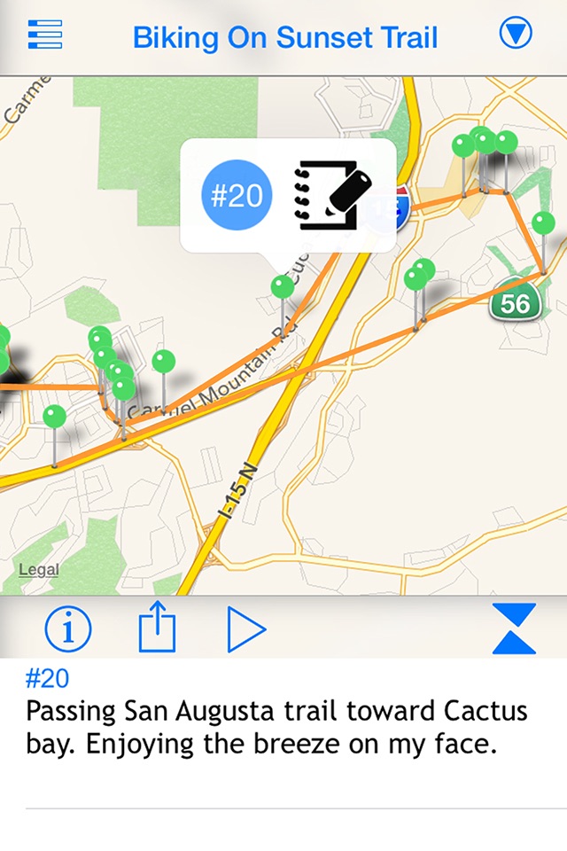
Lokate is optimized to create and maintain training and mission logs. You can create a log template with standard list items to standardize your logs and/or share with others.
Mapping & Navigation
• Map navigation styles: fixed, North-up, heading-up
• Map styles: street, satellite
• Map item overlays including Area, Path, and Markers
• 3D Terrain View: utilize a vertical slider to switch between 2D and 3D perspectives for better terrain awareness
• Map features HUD (Heads-Up Display) showing customizable parameters such as current position, speed, heading, altitude, distance to assignment, time on task, and more
• Adaptive scalable parameters: displayed values automatically adjust precision based on context
• HUD parameter copying: long-press on any HUD parameter to copy it to the clipboard
Assignment Recording
• Record handler’s position with configurable accuracy
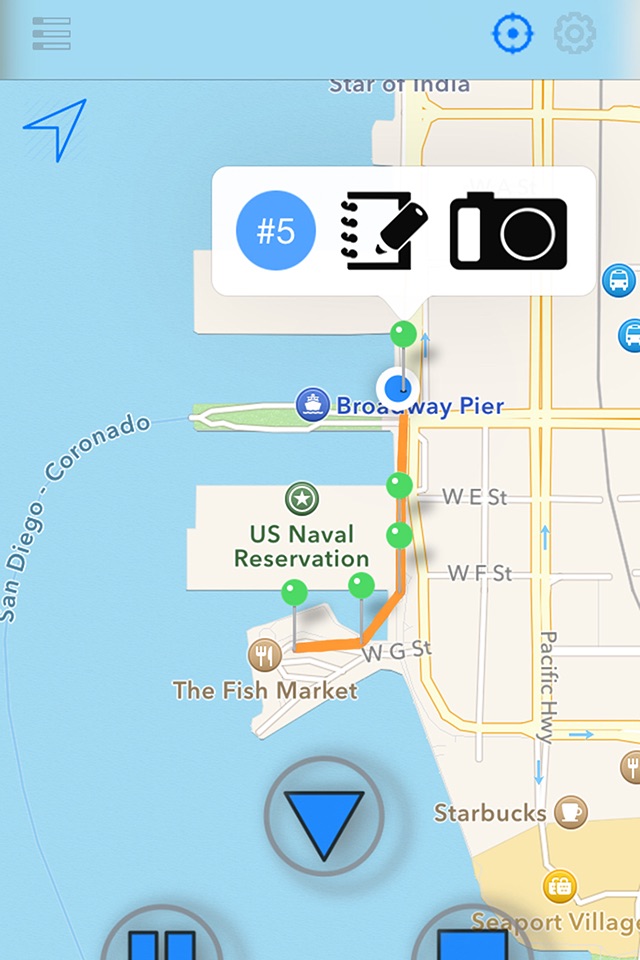
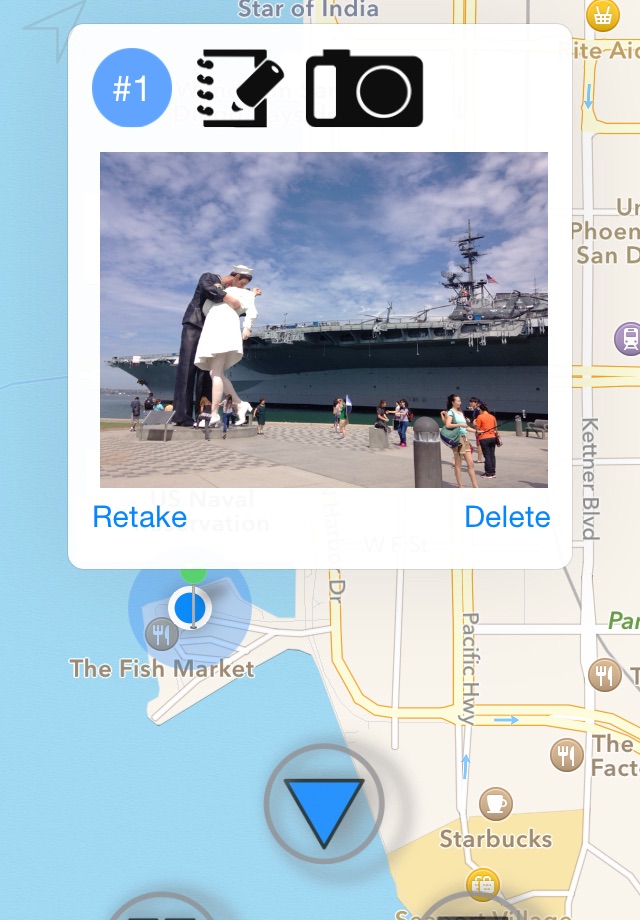
• Record found clues with geotagged text and/or images
• Images are stored securely within Lokate and include embedded metadata: position and heading at time of capture
• “Active Area” feature continuously tracks your position and distance to or within the assigned area
• Weather data collection: environmental data is logged alongside assignments or training sessions
Assignment Review & Log
• Review recorded assignments and/or import tracks from K9 or CalTopo
• Playback (in 10x speed) of tracks for in-depth review of what happened. Auto play, scrub and/or zoom-follow.
• Statistics of Assignment such as total distance of handler and K9, speeds etc.
• Full weather report with humidity, UV, wind (direction, speed, gusts), cloud cover etc. Weather report is recorded 1 hour prior to assignment all the way till 1 hour after assignment. This includes hider/subject for trailing problems.
Create handler or canine tracks from imported data for documentation or review
• Review and manage stored assignment recordings from the main screen
Logs, Templates & Standard Lists
• Create training logs using configurable templates and shared global lists for fast, consistent entry
• Log templates and global lists can be shared with other handlers for standardization
Import/Export GPS Data
• Import GPX or GeoJSON files from 3rd party applications
• Import GPX data directly from Garmin devices after missions or training sessions
• Export recorded track data to GeoJSON for use in other mapping tools
• Export log data to CSV format for use in spreadsheets or reporting systems
Apple Watch Support
• View Active Area position from your Apple Watch
• Mark your current position as a clue directly from the watch interface
• Instant location in lat/lon or USGN format.
Other
• Apple Shortcuts support: automate Lokate actions such as starting/stopping track recording or logging clues using Apple’s Shortcuts app