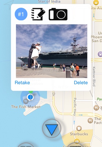
Lokate is an elegantly simple application aimed to help you combine GPS information, pictures and text to document your vacation trips, field surveys, mountain hikes and more. It is optimized to let you take a picture or note or both while it automatically records your location, speed, altitude and direction as a track point. Additionally, you may set it to record GPS information continually while you move about, taking notes and pictures at important moments.
You can keep a series of track points grouped together as a ‘track’. Tracks can be reviewed in your iPhone by note and/or picture. Moreover, you may upload an entire track to Dropbox as HTML document or KMZ file. The HTML document is ready to be opened in a web browser or word processor, KMZ file can be imported into Google Earth. Email sharing with a friend or colleague is a great way to show your trip.
Use Lokate to:
> Track your hiking trip, take pictures of the vistas you encounter, notes of what you saw.
> Document your vacation trip, where did you go, what did you see, what did you experience. Great to create your scrapbook or travel blog.
> Survey land or buildings, take pictures and notes of what needs repairing, adjusting, reporting.
> Document your field research (geology, animal density and track counting, biology etc.)
Start Your Trip:
- Just press a start button and Lokate can immediately show your GPS coordinate.
- Add your first track point whenever you are ready to move about on your walking, hiking or biking trip. Lokate will record your route wherever you go by showing an orange trace line while displaying Live Data such as Speed, Altitude, Distance travelled, Course as well as GPS coordinate.
- Want to add a journal ? drop more track point to add a note and/or take photo of what you see. Add more track point at any time and anywhere you are.
- Once you finish your trip just press a stop button. Lokate will save your entire track with you stats, journal and photos.
Review:
- Review your track any time you like by open up your specific route in the tracks list to see the route and your precious journal.
- Watch a slide show of your photos in the entire track right from your iPhone.
- Review each track point, or update your notes if you have something else to add.
Share:
- There are many ways to share your Tracks: Upload KMZ to Dropbox or email, Open your KMZ with Google Earth. Or create an HTML document and save to Dropbox. Open the HTML with your favorite browser or word processor.
You will find that Lokate is deceptively simple to use yet it provides a set of versatile functions to support many purposes.
Please note that Lokate uses the iPhones GPS receiver and that continued use of GPS running in the background can dramatically decrease battery life.


