


Lokate app for iPhone and iPad
Developer: Narumol Pugkhem
First release : 10 Feb 2016
App size: 3.59 Mb
Lokate 3 is a purposefully simple application aimed to record GPS tracks as you conduct your SAR (Search & Rescue) mission assignment. Set as a companion app to pro GPS tracking softwares such as CalTopo, it can be ran simultaneously with such applications and provides focus for just the work you are assigned to. Lokate 3 is particularly helpful to record you and your K9 tracks of missions or trainings for later study.
Many display customization options are available to accommodate your specific needs. Location data may be either USGN or decimal latitude, longitude. Length and speed may be set to English or metric. These values may also be shown as a HUD (heads up display) floating over the map. The map can be switched between stylized urban or satellite. Specifically for low light conditions where you need to preserve your night vision, Lokate 3 provides a dark filter you can specify the color of (usually set to red but any color can be chosen to best adapt to your specific eye sight).
Lokate’s map format can be “North Up” as well as “Direction Tracking” since it is common to want to switch between these formats frequently an always on the map button gives you direct access to this.
You may pause recording for an indefinite amount of time to keep the recording clean from travel to and from assignment area. Assignment area created in other software can be imported through geoJSON format. Track data can be imported through GPX. Recorded tracks including markers can be exported with GPX and geoJSON formats via messages, email, airdrop or directly into receiving applications. All exported data is automatically stored in your iCloud application folder for easy retrieval for your computer based applications. Lokate can export in HTML format; this creates a simple static webpage which can be shared or opened in document applications for further editing and printing.
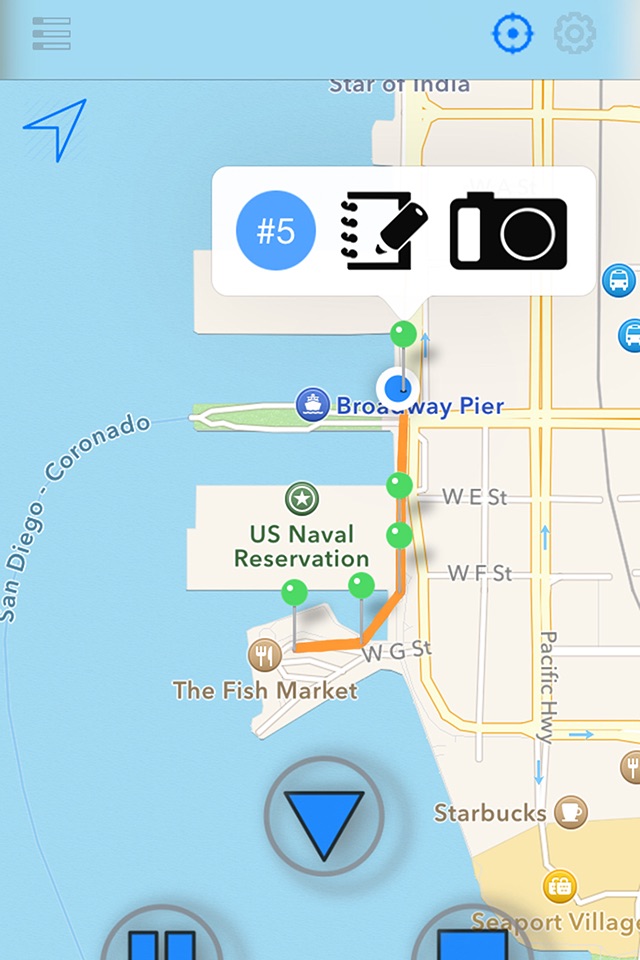
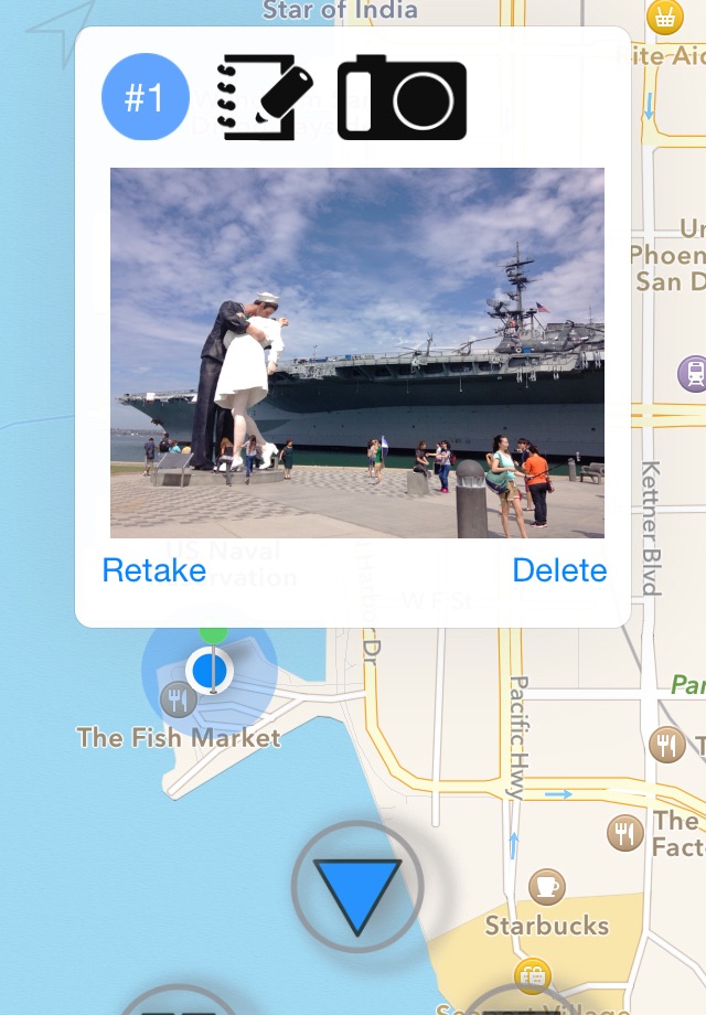
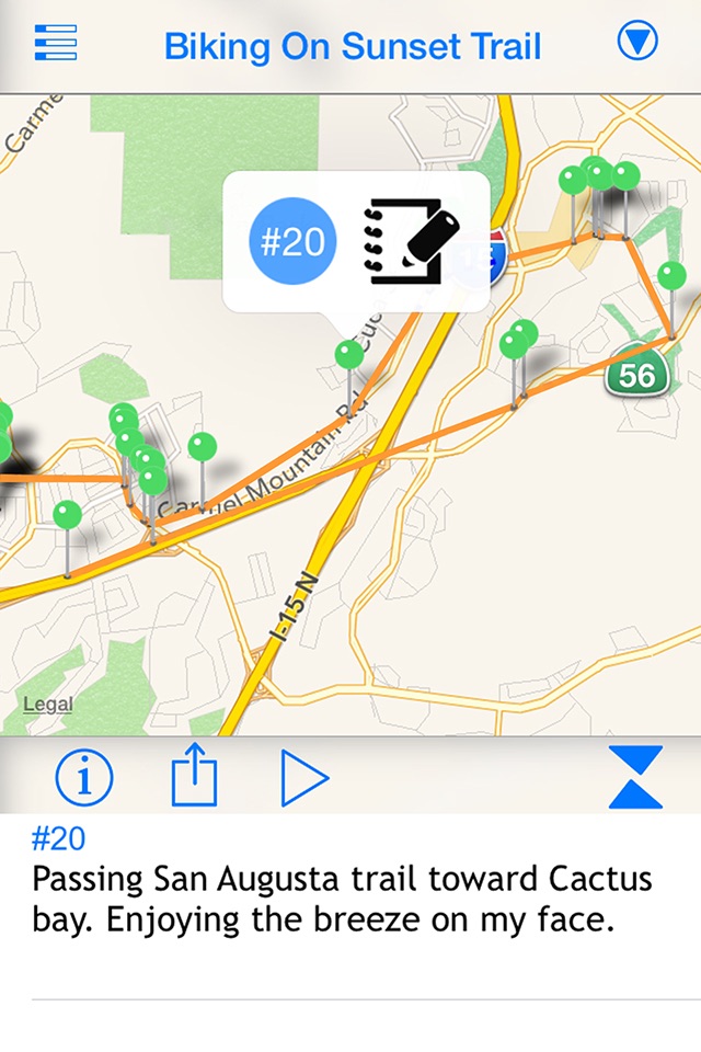
Recorded assignments are kept in a scrollable list for later review. The detail information includes a map with pins for marked locations. You may browse through a list of markers and click each to set the map’s center or pan trough the map. Press a pin (marker) to reveal its note and/or collected images. Lokate will also provide metric data of the start time and length of the track as well as average and maximum speed. For imported (K9) data which often consists of just GPS locations, speed and distance data will also be computed. Once recorded and stored, markers may be edited and images added. The time of the image as well as location taken is always preserved to keep the recording true.
Lokate 3 provides the ability to record markers along the mission or training so that you may record a note as well as take pictures of the site or object of interest. Images are kept in Lokate’s private storage so that they do not clutter your regular photo album and their meta data is updated with location and heading information.
While conducting the mission’s assignment, it is important to always know your location. Having your hands full with other equipment, leash etc, getting your phone out to report your location is not always easy. Therefore, the accompanying WatchApp for Lokate 3 shows live location information and is also able to create a marker.
Note 1: Lokate 3 does not directly interface with common K9 GPS trackers such as from Garmin. A more tight integration with tracking hardware is planned for future releases.
Note 2: Lokate 3 is NOT COMPATIBLE with Lokate 2 data formats. Data recorded with Lokate 2 should be exported (HTML export) prior to upgrading. All Lokate 2 data will be lost.